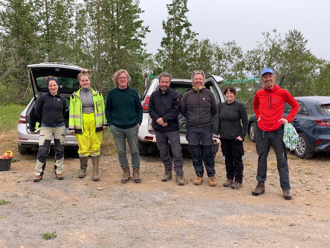
The Two Valley project had its first of two field seasons during the summer of 2021. Four teams of researchers and specialists gathered in the valleys of Svarfaðardalur and Hörgárdalur. They were investigating the questions put forward by the project on the development of society, environment and class in this area. The various teams had each its goals and methods to reach these goals.
Overview
The Two Valley project progressed on several fronts during the field season of 2021, which mostly took place in Svarfaðardalur. Among the highlights can be mentioned considerable addition to the archaeological analysis of settlement history during the period 877 to 1500. There are now signs of a first and second phase of settlement, with the first occurring during what might be termed „the long 10th century“. The second commenced after 950 until about 1100. A third phase became visible already in the 2020 research, when several deserted farms known from previous surveys were dated to have been settled during the period after Hekla 1104, probably in the 12th or 13th centuries. This phase was now seen in three or four deserted farms dated during the field season 2021.
An organised search for pre-christian burials on four farms located one possible burial, which remains to be tested at some later phase of research. Measurements of farm mounds resulted in very interesting results, were the smallest mound at the tiniest sub-tenancies was 30 times smaller than the largest, at a full and highly valued farm.
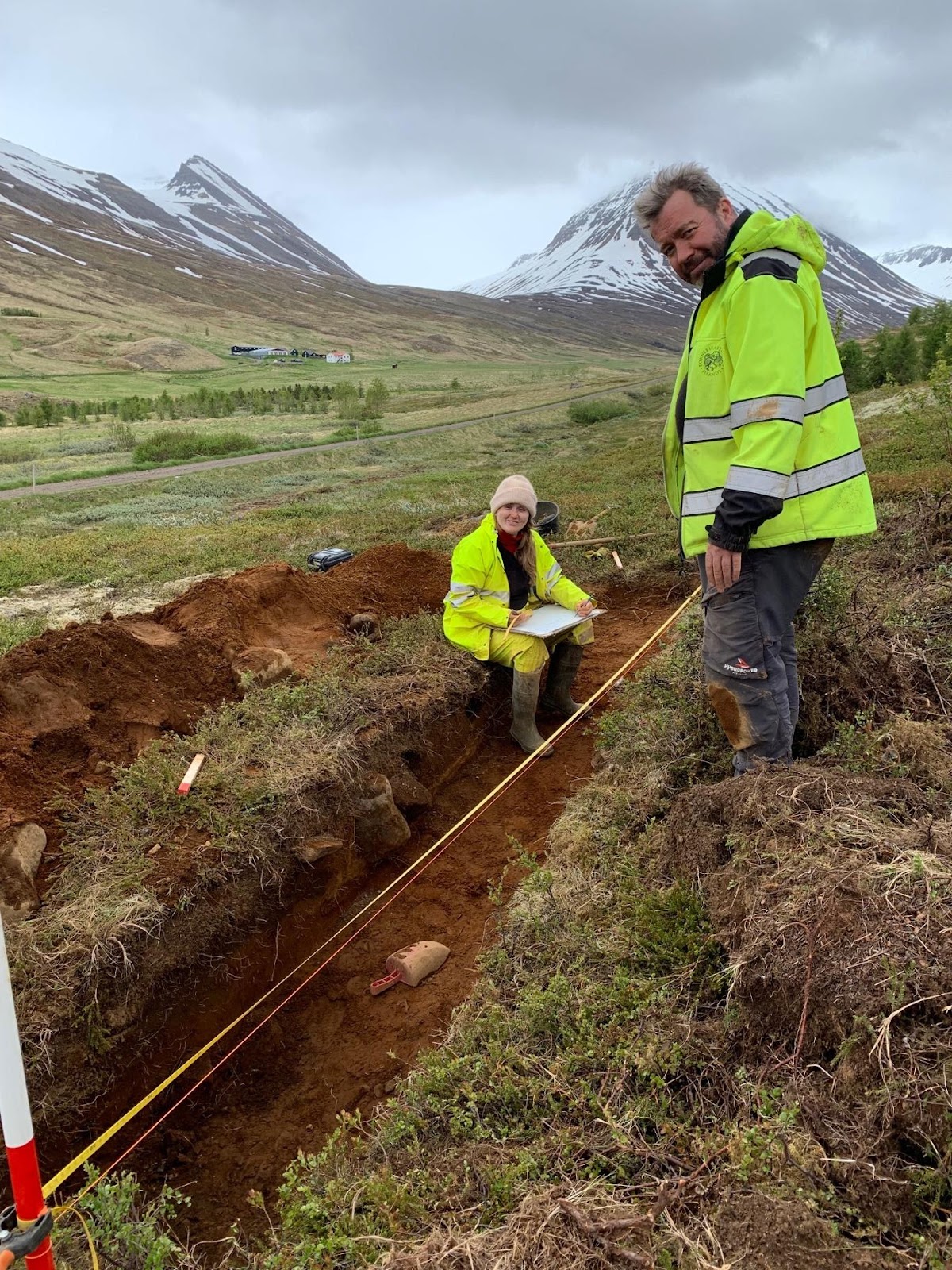
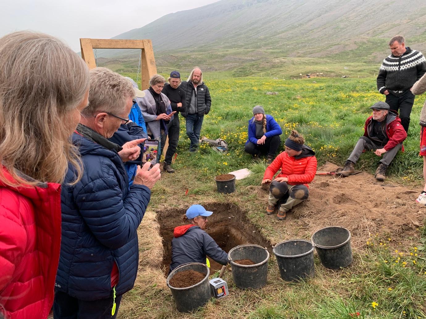
A second front was the zooarchaeology research. Middens were sought in four farms in Svarfaðardalur and located on three of these. Two of those were too disturbed to be of further use for the research, but the fourth, in Kóngsstaðir, was of use. A trench revealed a stratified midden, which however did not contain preserved bones, except for a few teeth. aDNA samples were taken with the aim of analysing fauna remains deposited at the midden. Also the clear stratigraphy could be utilized in the context of settlement research. The midden showed signs of abandonmend in the late middle ages, possibly related to the Black Death 1402-1404 which according to written sources wrought havoc on the settlement in Svarfaðardalur.
Three samples were taken for palaeoecological analysis. These were taken with the aim of analysing social stratification as it appeared in the pollen record, and other environmental changes occurring during the research period. Already it is clear that Svarfaðardalur is anomalous to some extent because of the very limited signs of erosion beginning at settlement. This might have something to do with the well organised land use structure visible in 10th century remains of earth walls, or possibly the heavy snowfall in the valley.
Geological research revealed that the Grund farms site, traditionally thought to have been the site of the first farm in Svarfaðardalur, appears to have been open land before settlement, in what was otherwise mostly forested landscape. This was probably because of the landslide activity of the Grund creek, originating in Nykurtjörn lake. Geological research revealed considerable scree activity, f.ex. during the early 18th century, with a huge landslide covering large parts of the homefield south of the farm in 1707. Further information on each part of the research will now be outlined.
Archaeology of settlement
The goals of this team, led by Elín Ósk Hreiðarsdóttir, is an analysis of the settlement pattern in the two valleys, how settlement started and how it developed. The aim of this research was to analyse the development of the class system: Were there any farms that developed later? If so, were they smaller and perhaps dependent on the earlier settled farms?
Timing the second wave
The team had two main research focuses in this respect. One of them was the analysis of timing of the settlement of the second wave of settlement in Svarfaðardalur. Originally the aims for this research were influenced by the fact that the inner or upper valleys in this area, the inner part of Svarfaðardalur and Skíðadalur show a marked difference in settlement pattern to the lower valley. The farms are of lower value, there are almost no kuml and few churches compared to the lower, central valley. The traditional number of main farms (lögbýli) in the lower valley was 32, while the number of farms in inner Svarfaðardalur was 16 and in Skíðadalur the number was same. The total number of farms in the inner valleys thus was 32, and of these 23 were smaller than 30 hdr., that is to say small farms, and 9 were 30 hdr. or larger, medium or large farms. In the lower valley the numbers were this way: The small farms were 17 and the medium and large farms 15. The number of kuml or pre-christian burial sites in the lower valley was 12 (with more than one burial in most of these), and in the upper valleys only one, in Dæli. The number of recorded churches was 13 in the lower valley and 9 in the upper valleys.

Deserted farms and shielings.
The other main focus of the research of the archaeology of settlement team was determining the age of the many deserted farms found in the area. Already in 2020 analysis had been carried out on four deserted farms in the area where Skíðadalur meets Svarfaðadalur. Some of these farms were very well preserved, with undamaged and clear haymeadow earth walls and clear signs of building structures. Others had been erased by 20th century hayfield leveling, but their presence was clear on aerial photographs taken in 1954. The results of this research suggested that these four farms had been settled sometime after 1104, in the 12th or 13th century. In the summer of 2021 six more farm ruins were investigated. Four of them lie in Skíðadalur, Þverárkot, Kot or Kotakot, Villingastaðir and Hvarfskot. The fifth was Krákustaðir in Tungur, and the sixth was the Upsasel shieling, which according to written sources had been active as a shieling from the parish church farm of Upsir in 1712. The results of this analysis can be seen in Table 2. Two deserted farms, Kot in Skíðadalur and Hvarfskot, proved to have been settled in the 12th or 13th centuries, while the third, Villingastaðir, proved older than 1766 but as sometimes happens lacked tephrochronological layers from 1104, 1300 or 1477.
Six or seven of the farms investigated in 2020 and 2021 seem to have been sub-tenancies, first mentioned in written sources in 1712 and then long deserted. Six of them were definitely settled in the 12th or 13th centuries, after 1104.
The earth walls on the other three farms investigated in 2021 all had different stories, in that they were older than 1104. Their stories was also different among themselves. One of them is very old, older than the other remains investigated in 2021, another one had the status of full farm until the 17th century, and the third was a shieling, not a farm, as far as we know.
It was the Krákustaðir ruin that proved to have been constructed very early, already in the 10th century. The Þverárkot homefield boundary was not as old, but older than the 1104 tephra. The Upsasel homefield boundary was also older than 1104, but younger than the 940 tephra, dated to around 980-1000. Both the age of the Krákustaðir ruin and the Þverárkot homefield correspond to the age of nearby property boundary earth walls analysed in the summer of 2021. It should be noted that Þverárkot was in settlement in the 17th century, probably with a period of desertion between the 14th and the 16th or early 17th century, as it appears on farms lists in 1686 and 1695. It was then a full or main farm (lögbýli).
Burial search
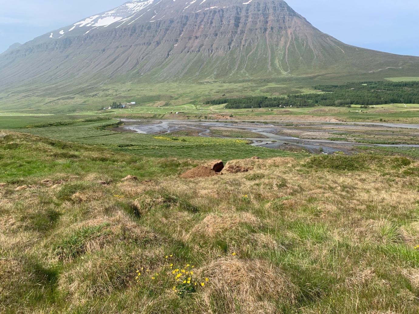
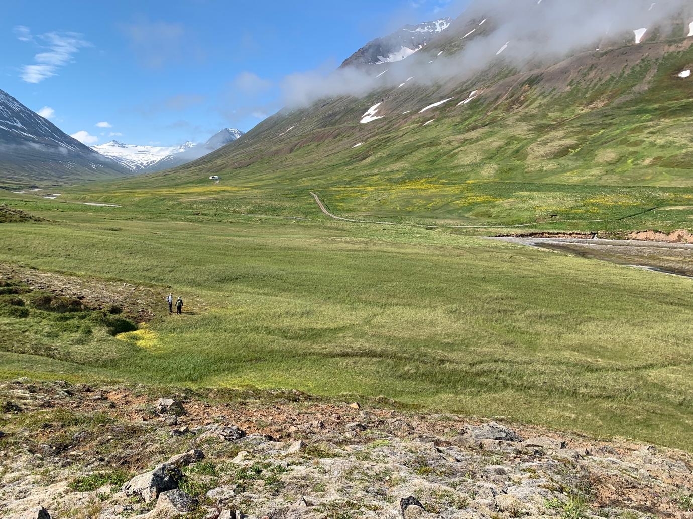
One of the clear differences between the outer part of Svarfaðardalur and the inner valleys is the ample heathen burial record known in the former and lack of the same in the latter. Most of the burials have been discovered by chance during road construction, home field levelling etc. that has happened to a greater degree in the outer areas and may therefore simply be a bias of discovery. In the last few years, we have started to understand a lot more about the topography of burials in Iceland and this summer Dr. Ruth Maher did a field walking experiment of four farms in the inner part of Svarfaðardalur and Skíðadalur in the attempt to locate possible pre-Christian burials. This was done by targeted fieldwalking based on location of known burials in the area and systematic transects and circular search patterns around elevated landscapes. The four farms chosen for preliminary pedestrian survey were: Atlastaðir and Skeið in Svarfaðardalur, and Klængshóll and Gljúfrárkot in Skíðadalur. The research question that guided the search was whether the lack of known burials in the inner part of Svarfaðardalur and Skíðadalur was likely to reflect a different or later settlement pattern or due to other factors relating to bias of recovery. Such factors might include lesser disturbance due the earlier abandonment or increased invisibility due to a larger impact from landslides.
Heathen burials in Iceland are generally unremarkable in appearance on the surface. The search covered a large area and the result was that no obvious burials were found on the four farms. The only possible exception to this was a small mound found and marked as a possible burial. Further trenching would be needed to determine the presence/absence of a burial there. No clear signs of heathen burials were discovered in the two inner valleys but that alone cannot be used to determine whether such burials exist in the area. However, the result of the field walking indicate that it might prove difficult locating pre-Christian burials in this area except with much more extensive research.
Farm mound assessments
Another element of the research in the summer of 2021 was systematic drone photography in order to evaluate farm mound size. Flights were conducted at seven farm mounds, at Hverhóll, Krákustaðir (on Tungufell land), Kot í Skíðadalur and Holárkot. Further drone mapping flights were carried out in Hörgárdalur – at Staðartunga (at both the farm mound and a presumed pre-Christinan burial site), at Skuggi, and at Myrkárdalur. The seven farms were of various status and value were subjected to this method. There is a clear and significant range in the scale of the farm mounds, and there are perhaps clusters of values rather than a continuous spread.
It is suggested that this technique may provide a rapid and affordable approach to mapping farm mounds and give a coarse estimate of the scale of archaeological remains. The gathered data may also prove to be of value and utility for many future studies of the sites addressed in this way. In terms of time and resources required, some broad estimates may be made. At or about 1000m² appears to be the lower limit for an independent farm – and even these are sites long since abandoned. Staðartunga is clearly exceptional within this group – and long since recognised as a large and important estate with a higher taxation value than the rest – but some levelling and spreading of the farm mound had taken place in the late 20th century that might have an effect of the measurements.
Zooarcheological research
Ramona Harrison has done extensive research in the Two Valleys area. In 2013 she defended her PhD on Hörgárdalur midden research at the City University of New York. Ramona did research on midden mounds at three Hörgárdalur sites, Möðruvellir, Oddstaðir and Skuggi. Extensive collections of animal bones were found at these sites, and through them Ramona analysed the economy and ecology of Hörgárdalur. Such research is appropriate when the animal bone remains are well-preserved and the midden layers are undisturbed and therefore well-stratified. In such a situation past human activities such as craft working, farming, resource utilization, access, and restriction, trade and exchange can be analysed. This can be achieved via faunal analysis on the macro- and the micro-level, with for example: isotope and trace element analysis, tooth microwear analysis, and aDNA analysis.
The bone analysis of Oddstaðir and Skuggi showed that cattle and farming were the most important farming activity in the valley during the middle ages. Both farms were abandoned during the middle ages, Skuggi in the 13th century and Oddstaðir in the 15th century. A fourth site in Hörgárdalur, Staðartunga, is the subject of the research in the Two Valleys project. Archaelogy PhD student Kristin Linnea Møller-Nielsen will analyse the Staðartunga midden. This site has the advantage over the two other sites that it was settled until the present day, and so information on changes in agriculture indicated by written sources in the 15th century can be obtained here.
During the summer of 2021 the zooarch team, led by dr. Harrison, did a survey of some Svarfaðardalur middens. Results from the Atlastaðir midden initially proved promising, but eventually it became clear that it was too disturbed. A chronology would be impossible to create. The same result was obtained at Hreiðarstaðir. No midden could be found at Kot in Skíðadalur. At Kóngstaðir in Skíðadalur, a small/medium farm, an undisturbed midden was found. It was excavated during the field season in 2021. However, it proved that visible bone remains had almost completely been obliterated by the high acidity of the soil. In Ramona´s words: „Unfortunately, despite the rigorous excavation and sampling methods implemented, the bone preservation in all the cultural layers was almost zero. With only few teeth remaining from some of the layers. Which is a sign of high acidity in the peat ash midden. The midden did reveal several undisturbed tephra layers. From most recent to earliest: H1477, H1300, V877, and possibly H1104 (still under analysis by members of WP5).“
Even so, a solid tephra sequence was established, analysed in the following way by Árni Hjartarson:
DNA-research is being conducted on a sample from the midden, which could at least partly compensate for the lack of visible bone material. In collaboration with WP4, Egill Erlendsson was able to submit the soil column taken from one of the midden sections for geochemichal and biochemical analysis. aDNA results from the soil may increase information on animal (and possibly plant) species once present in this midden.
Also the sequence in the trench wall at Kóngstaðir reveals interesting facts about the settlement at the farm. It seems that some way above the 1300 tephra all activity at the farm stopped, and then was taken up several decades or even some centuries later. This aspect of midden analysis, analysis of settlement through midden activity, is one of the focuses of the project. In the words of Ramona Harrison: „On initial analysis, it seems the area was occupied soon after Landnám, and in use until the High Middle Ages. Based on this midden trench, a post-1300 abandonment phase is currently suggested, with a presumed re-settlement phase in the post-medieval era. This information still needs to be corroborated with C14 dates and other specialist analysis expected in 2022.“
Palaeoecological research
During the field season dr. Egill Erlendsson and Elísabet Ásta Eyþórsdóttir, PhD student, visited the research area. They selected three sites, where samples where taken, soil cores from wetland soil, that will be the subject of Ásta´s doctoral research.
The strategy was to collect those samples across a socially hierachical (class) and altitudinal transect. This was achieved. A peat monolith sample from the farm Sakka in the lower, northern reaches of Svarfaðardalur was collected. Sakka is representative of a farm that is believed to have been of a high social standing from the onset of landnám. A second peat monolith sample was accrued from the abandoned farm Kot in the upper, southern reaches of Skíðadalur. This peat monolith will represent the environmental footprints of a lower-social level, (sub)tenancy-based household. A third peat monolith sample was taken from an area called Tunga, located geographically between Sakka and Kot and completes the altitudinal transect along the valley system. As primarily an outfield grazing area, the Tunga site is believed to be the most responsive to changes in magnitude and nature of historical land-use. As such is it is probably an area most likely to reflect land use change in response to the Black Death impact. The three samples and sample sites complete and fulfill the proposed sampling for WP4 for the year 2021. All the profiles were sampled to sufficient length (depth) to capture the whole historical period and to extend sufficiently long back into prehistoric stratigraphy. The length of the profiles was Sakka = 53 cm; Kot = 65 cm; Tunga = 82 cm. The profiles all allow for the proposed high-resolution approach.
Sedimentary analyses for WP4
All three samples were taken to the Globe Institute, University of Copenhagen, DK where they were analysed at high resolution (every mm) soil geochemistry and (at every 4 mm) magnetic susceptibility. Although the results are at a preliminary stage, they demonstrate an unusually muted envirornmental signal to the landnám itself and through the first centuries of settlement. This rather unexpected result is of interest and allows for the generation of the hypothesis that controlled land management in the area, perhaps witnessed by the extensive networks of medieval wall structures throughout the valleys, may have beensuccessful in preserving vegetation and the underlying soils.
The most prominent disturbance period, where landscape stability is compromised is the period after AD 1766. Another hypothesis can be developed on the basis of this data: It is well documented that land use was altered in this period. The change included increased reliance on sheep and winter grazing and from the general discourse it is clearly believed that those changes in the farming system are believed to behind the greatest episode of land degradation and desertification in Iceland. The actual tangible data to support this hypothesis are, however, exceedingly rare. This research may go some way to rectify this unfortunate shortage of data. These results can also be placed in context with a change in the farming system which relates to a shift from a carefully controlled form of land-use to a form where land-use (i.e. grazing) is much less controlled.
Also it is clear that all the sites provide an excellent tephra-based timline for the medieval period, which is the period of primary interest here.
Grund was according to Svarfdæla Saga the farm of Þorsteinn Svörfuður, one of the first settlers and an immigrant leader in the valley. The farm is located on the west side of the valley, 7 km from the seashore and the town Dalvík. It is mentioned in Sturlunga and many medieval documents. There was a manor and a church for many centuries at Grund. The highborn Halldóra Tumadóttir, the wife of Sighvatur Sturluson and Tumi, their youngest son, took refuge there after the defeat of Sighvatur and his sons in the Battle of Örlygsstaðir.
One of the wealthiest chieftains in the country, Þorsteinn Eyjólfsson, lawman in Urðir, owned Grund in the second half of the 14th century. He is documented as called it his best estate in the North. Bishop Jón Arason acquired the farm in the 16th century and gave it to his daughter Þórunn. After the Reformation and murder of the bishop and his sons in Skálholt in 1550, the king’s authorities forced the farm out of her hands. After that it was considered a royal property until the 20th century.
Flash floods in Grundargil Gorge are mentioned already in the Jarðabók ÁM & PV in 1712. After that they are mentioned in all the main works about the geography of Iceland, Ferðabók Eggerts og Bjarna, Ferðabók Ólavíusar, Ferðabók Þorvaldar Thoroddsen and in Þjóðsögur Jóns Árnasonar.
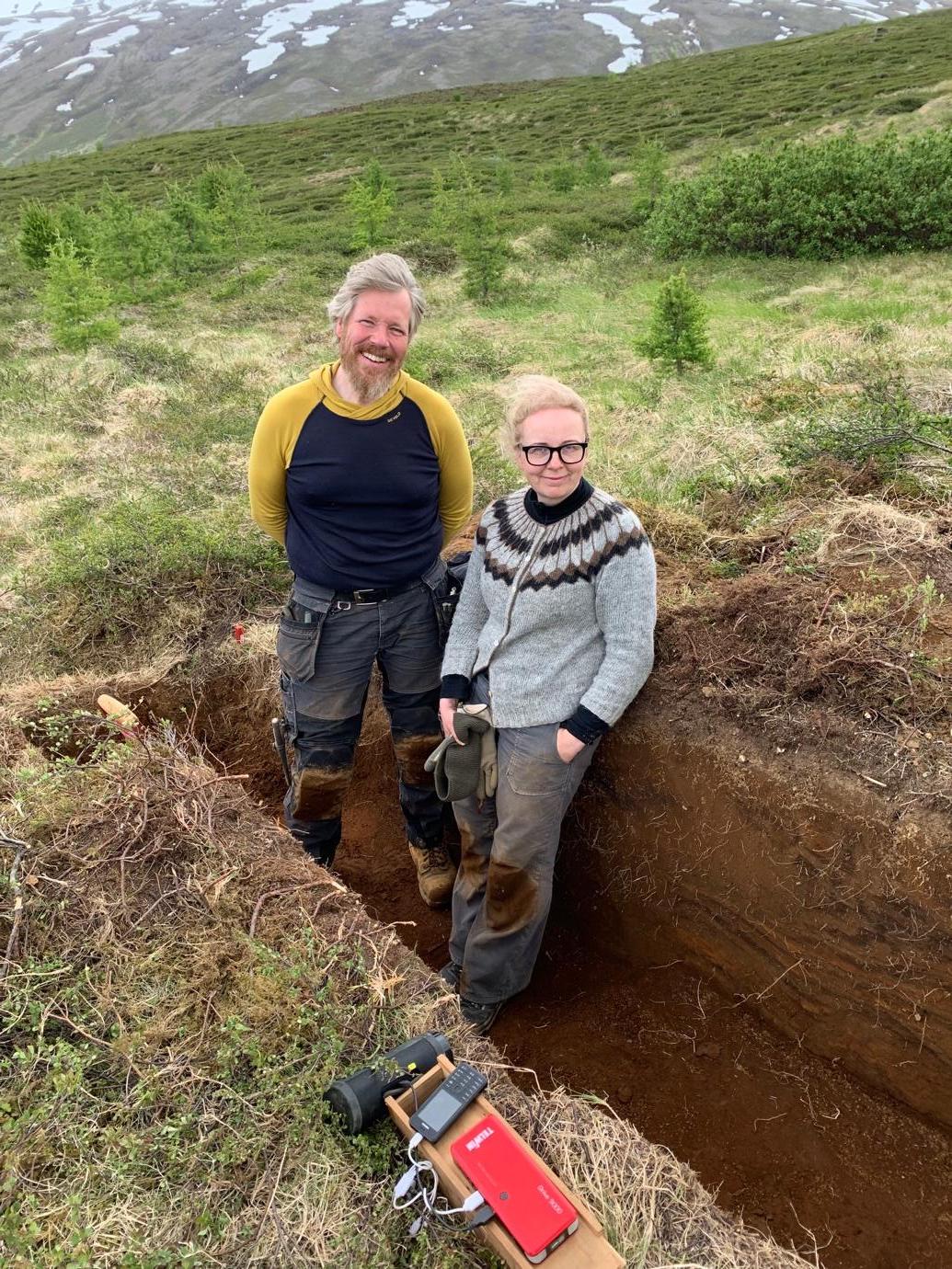
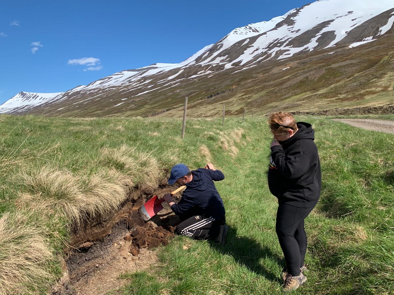
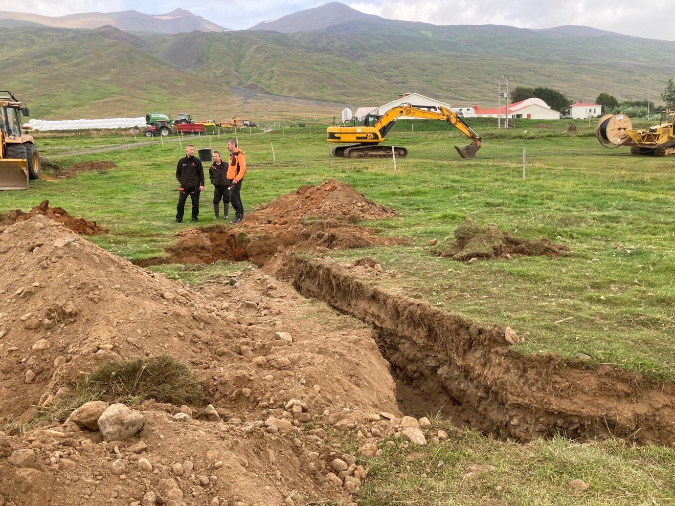
Why did the immigrant leader Þorsteinn svörfuður (or whatever his name was) locate his farm just below a very dangerous scree canyon in Svarfaðardalur? Was this because of a lack of experience and knowledge about the new environment where he and his partners were settling. Or did the scree activity in the Grundarlækur gorge start late, long after the age of the settlement? To answer this question it was decided to dig several survey pits for measurements and logging. The profiles could throw a light on the problem. Using debris layers from landslides and soil layers with tephra markers it might be possible to find out the geological history and frequency of landslides in the area.
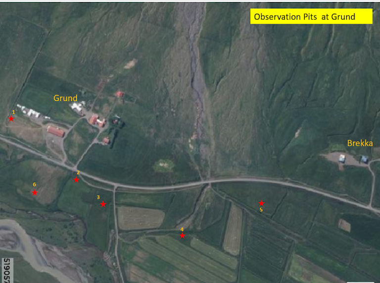
Observation pits
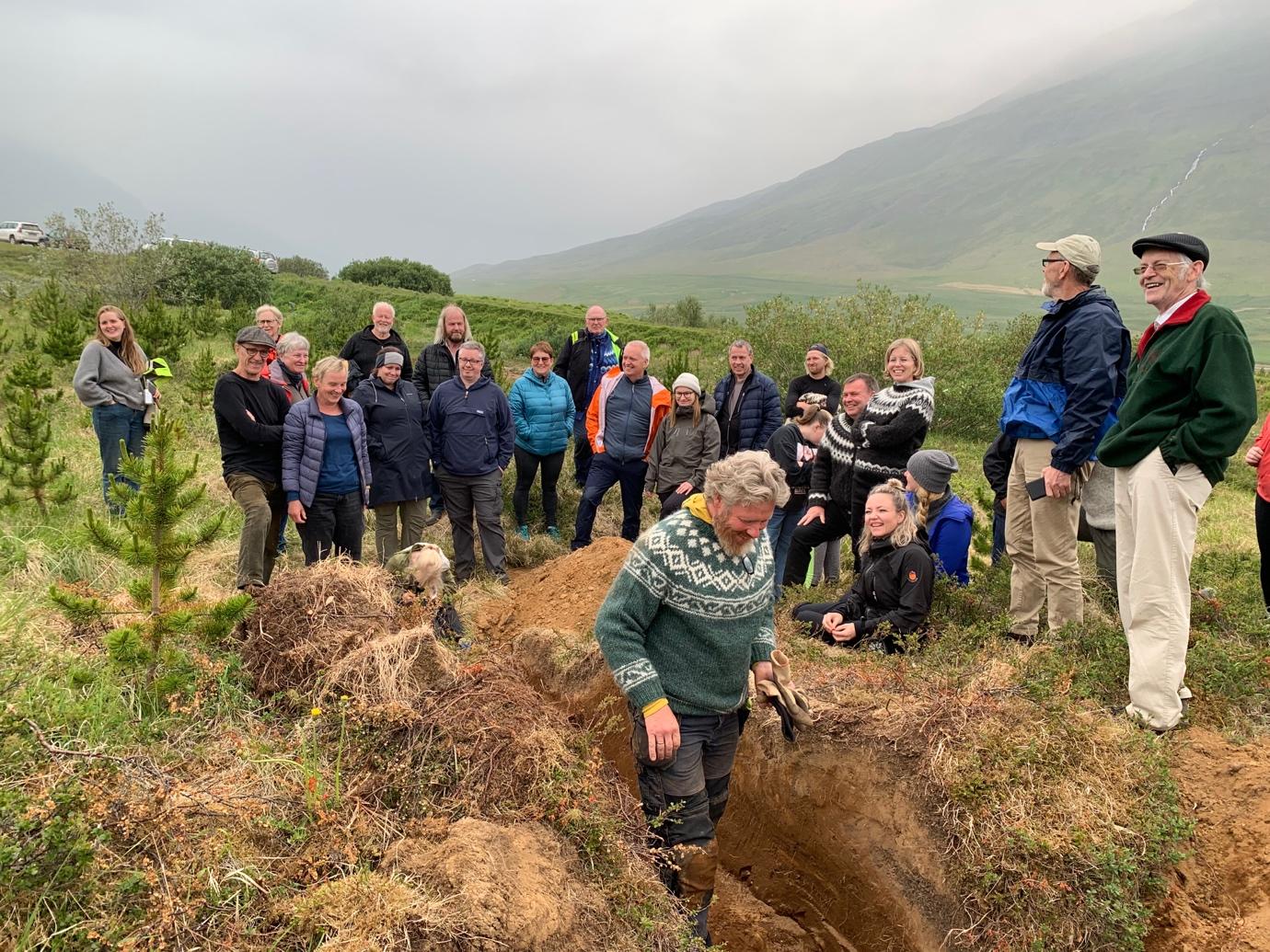
In August 2021 six deep observation pits were dug in the Grundargil and Ljósgil alluvial cones using a machine excavator. Their dept and locations are given in table 4.
Discussion of the profiles
The main suggestions that can be made after this investigation is that the profiles reflect frequent flows and landslides all through the historical time, both in Grundargil and Ljósgil Gorges. The main activity is on the northern part of the Grundargil alluvial cone and on the Ljósgil alluvial cone. The southern part of the Grundargil cone has suffered much less flows with long periods with no considerable flooding in between. It is noteworthy that no remains of a forest appeared in the profiles, the only traces of trees or shrubs were seen in observation pit 6. The large alluvial cones of Grundargil and Ljósgil appear to have been open landscape without birch and bushes and seems accordingly to have been an excellent pasture for livestock. This can explain why it was so attractive in the eyes of the first settlers that they chose this very place above all others in the valley for their new home.
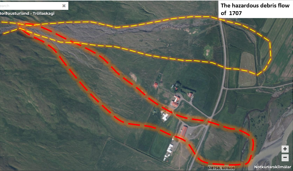
The large landslide of 1707
The profile from observation pit 6 differs from all the other profiles. There a thick continuous scree layer is found reaching from a thin layer (10 cm) of the surface soil and grass roots down to 3,6 m depth, below it are pure turf and soil layers with wood pieces. This is by far the thickest scree layer found in the field area. The thin soil layer covering the scree indicates a recent catastrophic landslide. This seems to be a manifestation of the large landslide mentioned in the Jarðabók occurring in the year 1707. Its size and path has been unknown until now. Unlike most other historical landslides, that flowed down the northern part of the alluvial cone of Grundarlækur stream, this one seems to have rushed down the southern part of the cone all the way to the river Svarfaðardalsá leaving the farm houses on an island in between the screes and the river.
Conclusions
- Continuous landslide activity has taken place in Grundargil for some thousands of years
- Ljósgil has also been an active landslide channel through the historical time
- At least one large landslide has occurred in Brekkugil in historical times
- No signs of quiescence are found during the Age of Settlement
- The main activity has been in the northernmost part of the Grundargil alluvial cone and in the Ljósgil alluvial cone.
- Very few events have happened in the southern part of the Grundargil alluvial cone.
- However the largest known flash flood and landslide from Nykurtjörn through the Grundargil canyon occurred in 1707 leading to temporary desolation of the farm some years later.
- No remains of trees (trunks of birch and willow) were found in the soil profiles except in no. 6.
- The Grundargil Alluvial Cone seems to have been open pasture and without birch and willow at settlement.
- The open landscape might have been attractive in the eyes of the settlers as pasture for their livestock.
- It seems that the settlers were not aware of the land-slide danger. If they were, then there must have been specific reasons for their choice of settlement location.
Introduction, keynote talk
The first annual project meeting of the Two Valley project took place at the Neskirkja community center, Hagatorg, Reykjavík. The out of town guests were accommodated at the Hótel Reykjavík Centrum in Aðalstræti. Present at the meeting were the participants in the project with invited speakers and other guests.
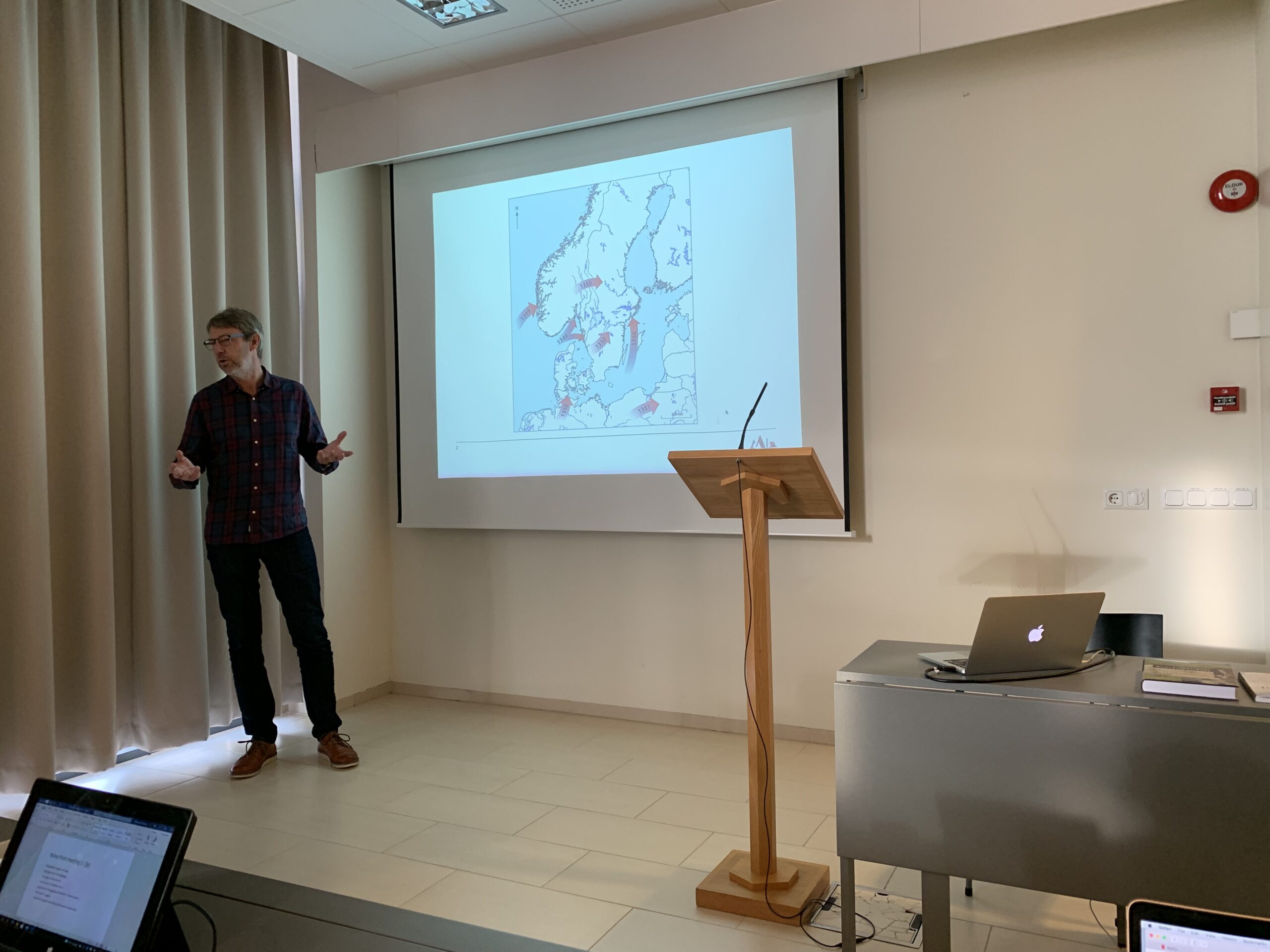
The meeting started at 10 am with an introduction by the leaders of the project, Ramona and Árni Daníel. After that the invited key speaker, Per Lagerås from Lund University, Sweden, gave his talk „Abandonment and agricultural change in the wake of the Black Death. A review of pollen and dendrochronological data from the South-Swedish uplands.“ He presented this material in a 30 minutes lecture, pointing out that there were few written records from the time and analysis of the events and developments surrounding the Black Death had mostly been analysed retrogressively with later records. He described the research project on the Black Death in Sweden he had lead, applying an interdisciplinary perspective with pollen analysis, dendrochronology, human osteology and archaeology as the methods of analysis, and that with this approach the scarcity of records suddenly was no more. Sweden has rich records, if this method is used.
Per then proceeded in describing the research on the Black Death in pollen data, which had been done using 21 pollen sites in the South-Swedish uplands. One of the key data analysed was cereal pollen that showed a strong decline after 1350, the time of the Black Death. It had immediate effect on upland societies. Cereal cultivation dropped by c. 50%. The dendrochronolical data pointed in the same direction. Per described how this changed the interpretation of the impact of the Black Death in Swedish historiography, with the impact now being deemed much higher than earlier estimates. The resulting changes in the research area were from intensive agriculture to a period of total abandonment and woodland re-growth, thereafter a return of agriculture with a much more extensive agriculture than before. This very interesting re-evaluation of the history of Black Death in Sweden was very well received by the participants in the meeting.
The work packages presented
The dean of the Faculty of Humanities of the University of Iceland then gave a short address, before each of the six work packages was presented by the work package leaders.
The state of the research of the first wp, on settlement research was introduced by archaeologists Elín Ósk Hreiðarsdóttir and Howell Roberts. Elín Ósk presented a talk about previous archaeological investigation in Svarfaðardalur and the first results from the fieldwork of WP1 during the summer. Then Howell presented a GIS analysis of the farm mound at Staðartunga, revealing a very big farm mound.
The second WP was presented by zooarchaeologist and professor at Bergen University Ramona Harrison and PhD student Kristin Møller-Nilsen. Ramona described the zooarch plan, with several collaborators in Orkney, Scotland and North-Carolina, and gave an account of the research during the fieldwork in Svarfaðardalur in the summer. Kristin presented her work plan, her background and the theoretical framework of the project.
The third WP, history was presented by the WP leader Axel Kristinsson, with a presentation of theoretical aspects of the historical analysis in the Two Valleys project. The fourth WP, palaeoecology was presented by prof. Egill Erlendsson at the University of Iceland and his PhD student, Elísabet Ásta Eyþórsdóttir. Egill discussed key themes for the work package, among them changes in land use and social structure and environmental significance of the plague. Ásta described her research plan for the PhD project, study area, research locations and the research undertaken during the summer.
Work package five was presented by geologists Árni Hjartarson and Sveinn Brynjólfsson. Árni, the WP leader presented with the other participants in the wp, Sveinn and Halldór G. Pétursson a general overview of geomorphology and natural hazards in the research area, along with an account of the research of the summer, focused on landslides in Grund, Svarfaðardalur. Sveinn Brynjólfsson then gave an overview of landslides in Hörgárdalur and Svarfaðardalur. Work package six was not presented, as it had not become active at the time.
The last lecture of the day was a presentation by Helgi Þorláksson about the Reykholt project, an interdisciplinary project focused on the manor of Reykholt in Borgarfjörður. Among the things Helgi mentioned was the decrease in woodland in the slopes above Reykholt in the 13th century, which is interesting in the light of results from the Two Valley project and the related Transice project about woodland development in Sakka, Svarfaðardalur.
In the evening the participants in the meeting, those who could and wanted, attended a dinner at the Sumac restaurant in Laugavegur. Everyone was happy with the food and drinks offered, it seems.
Day two: Overview, discussion
On the second day the meeting proceeded with an overview or outline by the project leaders of the social, environment and political development in Svarfaðardalur and Hörgárdalur 870 to 1500, presented by Árni Daníel Júlíusson. Then historian Helgi Skúli Kjartansson and archaeologist Guðmundur Ólafsson commented on the project, and a general discussion followed. After lunch Guðný Zoëga, archaeology professor at Hólar University, gave a talk from Hólar about the Skagafjörður archaeological project.
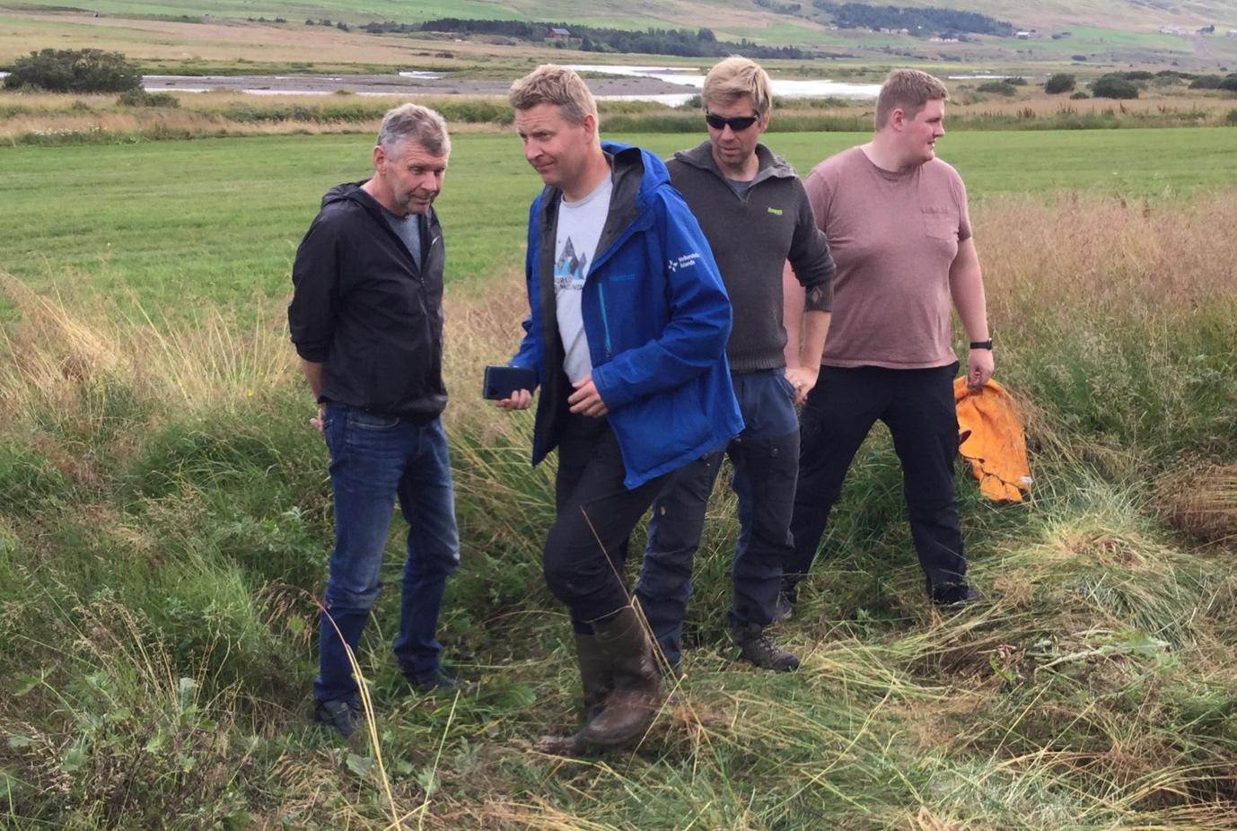
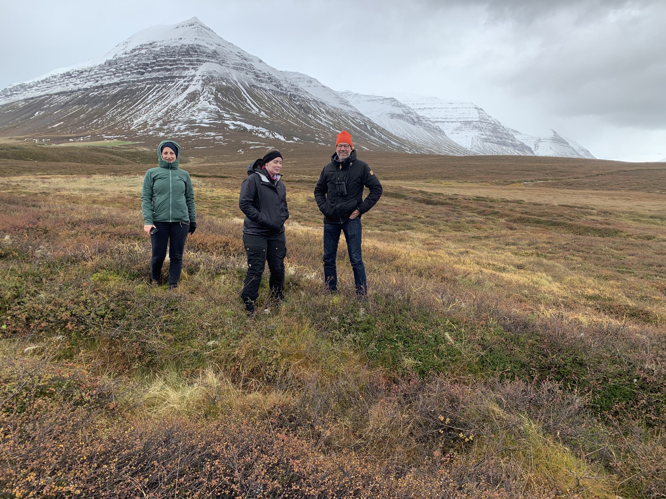
After that the open part of the program was finished, and meetings in smaller groups about project planning were held. Participants were happy with the meeting, which Andri M. Kristjánsson helped organising on the behalf of the Faculty of Humanities, University of Iceland. The workshop dinner was at the Sumac restaurant in Laugarvegur, Reykjavík. The day after the meeting four of the participants, Per Lagerås, Ramona Harrison, Kristin Møller-Nilsen and Árni Daníel Júlíusson travelled north to the research area and inspected it in the October cold weather.
Overview
The Two Valley project progressed on several fronts during the field season of 2021, which mostly took place in Svarfaðardalur. Among the highlights can be mentioned considerable addition to the archaeological analysis of settlement history during the period 877 to 1500. There are now signs of a first and second phase of settlement, with the first occurring during what might be termed „the long 10th century“. The second commenced after 950 until about 1100. A third phase became visible already in the 2020 research, when several deserted farms known from previous surveys were dated to have been settled during the period after Hekla 1104, probably in the 12th or 13th centuries. This phase was now seen in three or four deserted farms dated during the field season 2021.
An organised search for pre-christian burials on four farms located one possible burial, which remains to be tested at some later phase of research. Measurements of farm mounds resulted in very interesting results, were the smallest mound at the tiniest sub-tenancies was 30 times smaller than the largest, at a full and highly valued farm.
A second front was the zooarchaeology research. Middens were sought in four farms in Svarfaðardalur and located on three of these. Two of those were too disturbed to be of further use for the research, but the fourth, in Kóngsstaðir, was of use. A trench revealed a stratified midden, which however did not contain preserved bones, except for a few teeth. aDNA samples were taken with the aim of analysing fauna remains deposited at the midden. Also the clear stratigraphy could be utilized in the context of settlement research. The midden showed signs of abandonmend in the late middle ages, possibly related to the Black Death 1402-1404 which according to written sources wrought havoc on the settlement in Svarfaðardalur.
Three samples were taken for palaeoecological analysis. These were taken with the aim of analysing social stratification as it appeared in the pollen record, and other environmental changes occurring during the research period. Already it is clear that Svarfaðardalur is anomalous to some extent because of the very limited signs of erosion beginning at settlement. This might have something to do with the well organised land use structure visible in 10th century remains of earth walls, or possibly the heavy snowfall in the valley.
Geological research revealed that the Grund farms site, traditionally thought to have been the site of the first farm in Svarfaðardalur, appears to have been open land before settlement, in what was otherwise mostly forested landscape. This was probably because of the landslide activity of the Grund creek, originating in Nykurtjörn lake. Geological research revealed considerable scree activity, f.ex. during the early 18th century, with a huge landslide covering large parts of the homefield south of the farm in 1707. Further information on each part of the research will now be outlined.
Archaeology of settlement
The goals of this team, led by Elín Ósk Hreiðarsdóttir, is an analysis of the settlement pattern in the two valleys, how settlement started and how it developed. The aim of this research was to analyse the development of the class system: Were there any farms that developed later? If so, were they smaller and perhaps dependent on the earlier settled farms?
Timing the second wave
The team had two main research focuses in this respect. One of them was the analysis of timing of the settlement of the second wave of settlement in Svarfaðardalur. Originally the aims for this research were influenced by the fact that the inner or upper valleys in this area, the inner part of Svarfaðardalur and Skíðadalur show a marked difference in settlement pattern to the lower valley. The farms are of lower value, there are almost no kuml and few churches compared to the lower, central valley. The traditional number of main farms (lögbýli) in the lower valley was 32, while the number of farms in inner Svarfaðardalur was 16 and in Skíðadalur the number was same. The total number of farms in the inner valleys thus was 32, and of these 23 were smaller than 30 hdr., that is to say small farms, and 9 were 30 hdr. or larger, medium or large farms. In the lower valley the numbers were this way: The small farms were 17 and the medium and large farms 15. The number of kuml or pre-christian burial sites in the lower valley was 12 (with more than one burial in most of these), and in the upper valleys only one, in Dæli. The number of recorded churches was 13 in the lower valley and 9 in the upper valleys.
Deserted farms and shielings.
The other main focus of the research of the archaeology of settlement team was determining the age of the many deserted farms found in the area. Already in 2020 analysis had been carried out on four deserted farms in the area where Skíðadalur meets Svarfaðadalur. Some of these farms were very well preserved, with undamaged and clear haymeadow earth walls and clear signs of building structures. Others had been erased by 20th century hayfield leveling, but their presence was clear on aerial photographs taken in 1954. The results of this research suggested that these four farms had been settled sometime after 1104, in the 12th or 13th century. In the summer of 2021 six more farm ruins were investigated. Four of them lie in Skíðadalur, Þverárkot, Kot or Kotakot, Villingastaðir and Hvarfskot. The fifth was Krákustaðir in Tungur, and the sixth was the Upsasel shieling, which according to written sources had been active as a shieling from the parish church farm of Upsir in 1712. The results of this analysis can be seen in Table 2. Two deserted farms, Kot in Skíðadalur and Hvarfskot, proved to have been settled in the 12th or 13th centuries, while the third, Villingastaðir, proved older than 1766 but as sometimes happens lacked tephrochronological layers from 1104, 1300 or 1477.
Six or seven of the farms investigated in 2020 and 2021 seem to have been sub-tenancies, first mentioned in written sources in 1712 and then long deserted. Six of them were definitely settled in the 12th or 13th centuries, after 1104.
The earth walls on the other three farms investigated in 2021 all had different stories, in that they were older than 1104. Their stories was also different among themselves. One of them is very old, older than the other remains investigated in 2021, another one had the status of full farm until the 17th century, and the third was a shieling, not a farm, as far as we know.
It was the Krákustaðir ruin that proved to have been constructed very early, already in the 10th century. The Þverárkot homefield boundary was not as old, but older than the 1104 tephra. The Upsasel homefield boundary was also older than 1104, but younger than the 940 tephra, dated to around 980-1000. Both the age of the Krákustaðir ruin and the Þverárkot homefield correspond to the age of nearby property boundary earth walls analysed in the summer of 2021. It should be noted that Þverárkot was in settlement in the 17th century, probably with a period of desertion between the 14th and the 16th or early 17th century, as it appears on farms lists in 1686 and 1695. It was then a full or main farm (lögbýli).
Burial search
One of the clear differences between the outer part of Svarfaðardalur and the inner valleys is the ample heathen burial record known in the former and lack of the same in the latter. Most of the burials have been discovered by chance during road construction, home field levelling etc. that has happened to a greater degree in the outer areas and may therefore simply be a bias of discovery. In the last few years, we have started to understand a lot more about the topography of burials in Iceland and this summer Dr. Ruth Maher did a field walking experiment of four farms in the inner part of Svarfaðardalur and Skíðadalur in the attempt to locate possible pre-Christian burials. This was done by targeted fieldwalking based on location of known burials in the area and systematic transects and circular search patterns around elevated landscapes. The four farms chosen for preliminary pedestrian survey were: Atlastaðir and Skeið in Svarfaðardalur, and Klængshóll and Gljúfrárkot in Skíðadalur. The research question that guided the search was whether the lack of known burials in the inner part of Svarfaðardalur and Skíðadalur was likely to reflect a different or later settlement pattern or due to other factors relating to bias of recovery. Such factors might include lesser disturbance due the earlier abandonment or increased invisibility due to a larger impact from landslides.
Heathen burials in Iceland are generally unremarkable in appearance on the surface. The search covered a large area and the result was that no obvious burials were found on the four farms. The only possible exception to this was a small mound found and marked as a possible burial. Further trenching would be needed to determine the presence/absence of a burial there. No clear signs of heathen burials were discovered in the two inner valleys but that alone cannot be used to determine whether such burials exist in the area. However, the result of the field walking indicate that it might prove difficult locating pre-Christian burials in this area except with much more extensive research.
Farm mound assessments
Another element of the research in the summer of 2021 was systematic drone photography in order to evaluate farm mound size. Flights were conducted at seven farm mounds, at Hverhóll, Krákustaðir (on Tungufell land), Kot í Skíðadalur and Holárkot. Further drone mapping flights were carried out in Hörgárdalur – at Staðartunga (at both the farm mound and a presumed pre-Christinan burial site), at Skuggi, and at Myrkárdalur. The seven farms were of various status and value were subjected to this method. There is a clear and significant range in the scale of the farm mounds, and there are perhaps clusters of values rather than a continuous spread.
It is suggested that this technique may provide a rapid and affordable approach to mapping farm mounds and give a coarse estimate of the scale of archaeological remains. The gathered data may also prove to be of value and utility for many future studies of the sites addressed in this way. In terms of time and resources required, some broad estimates may be made. At or about 1000m² appears to be the lower limit for an independent farm – and even these are sites long since abandoned. Staðartunga is clearly exceptional within this group – and long since recognised as a large and important estate with a higher taxation value than the rest – but some levelling and spreading of the farm mound had taken place in the late 20th century that might have an effect of the measurements.
Zooarcheological research
Ramona Harrison has done extensive research in the Two Valleys area. In 2013 she defended her PhD on Hörgárdalur midden research at the City University of New York. Ramona did research on midden mounds at three Hörgárdalur sites, Möðruvellir, Oddstaðir and Skuggi. Extensive collections of animal bones were found at these sites, and through them Ramona analysed the economy and ecology of Hörgárdalur. Such research is appropriate when the animal bone remains are well-preserved and the midden layers are undisturbed and therefore well-stratified. In such a situation past human activities such as craft working, farming, resource utilization, access, and restriction, trade and exchange can be analysed. This can be achieved via faunal analysis on the macro- and the micro-level, with for example: isotope and trace element analysis, tooth microwear analysis, and aDNA analysis.
The bone analysis of Oddstaðir and Skuggi showed that cattle and farming were the most important farming activity in the valley during the middle ages. Both farms were abandoned during the middle ages, Skuggi in the 13th century and Oddstaðir in the 15th century. A fourth site in Hörgárdalur, Staðartunga, is the subject of the research in the Two Valleys project. Archaelogy PhD student Kristin Linnea Møller-Nielsen will analyse the Staðartunga midden. This site has the advantage over the two other sites that it was settled until the present day, and so information on changes in agriculture indicated by written sources in the 15th century can be obtained here.
During the summer of 2021 the zooarch team, led by dr. Harrison, did a survey of some Svarfaðardalur middens. Results from the Atlastaðir midden initially proved promising, but eventually it became clear that it was too disturbed. A chronology would be impossible to create. The same result was obtained at Hreiðarstaðir. No midden could be found at Kot in Skíðadalur. At Kóngstaðir in Skíðadalur, a small/medium farm, an undisturbed midden was found. It was excavated during the field season in 2021. However, it proved that visible bone remains had almost completely been obliterated by the high acidity of the soil. In Ramona´s words: „Unfortunately, despite the rigorous excavation and sampling methods implemented, the bone preservation in all the cultural layers was almost zero. With only few teeth remaining from some of the layers. Which is a sign of high acidity in the peat ash midden. The midden did reveal several undisturbed tephra layers. From most recent to earliest: H1477, H1300, V877, and possibly H1104 (still under analysis by members of WP5).“
Even so, a solid tephra sequence was established, analysed in the following way by Árni Hjartarson:
DNA-research is being conducted on a sample from the midden, which could at least partly compensate for the lack of visible bone material. In collaboration with WP4, Egill Erlendsson was able to submit the soil column taken from one of the midden sections for geochemichal and biochemical analysis. aDNA results from the soil may increase information on animal (and possibly plant) species once present in this midden.
Also the sequence in the trench wall at Kóngstaðir reveals interesting facts about the settlement at the farm. It seems that some way above the 1300 tephra all activity at the farm stopped, and then was taken up several decades or even some centuries later. This aspect of midden analysis, analysis of settlement through midden activity, is one of the focuses of the project. In the words of Ramona Harrison: „On initial analysis, it seems the area was occupied soon after Landnám, and in use until the High Middle Ages. Based on this midden trench, a post-1300 abandonment phase is currently suggested, with a presumed re-settlement phase in the post-medieval era. This information still needs to be corroborated with C14 dates and other specialist analysis expected in 2022.“
Palaeoecological research
During the field season dr. Egill Erlendsson and Elísabet Ásta Eyþórsdóttir, PhD student, visited the research area. They selected three sites, where samples where taken, soil cores from wetland soil, that will be the subject of Ásta´s doctoral research.
The strategy was to collect those samples across a socially hierachical (class) and altitudinal transect. This was achieved. A peat monolith sample from the farm Sakka in the lower, northern reaches of Svarfaðardalur was collected. Sakka is representative of a farm that is believed to have been of a high social standing from the onset of landnám. A second peat monolith sample was accrued from the abandoned farm Kot in the upper, southern reaches of Skíðadalur. This peat monolith will represent the environmental footprints of a lower-social level, (sub)tenancy-based household. A third peat monolith sample was taken from an area called Tunga, located geographically between Sakka and Kot and completes the altitudinal transect along the valley system. As primarily an outfield grazing area, the Tunga site is believed to be the most responsive to changes in magnitude and nature of historical land-use. As such is it is probably an area most likely to reflect land use change in response to the Black Death impact. The three samples and sample sites complete and fulfill the proposed sampling for WP4 for the year 2021. All the profiles were sampled to sufficient length (depth) to capture the whole historical period and to extend sufficiently long back into prehistoric stratigraphy. The length of the profiles was Sakka = 53 cm; Kot = 65 cm; Tunga = 82 cm. The profiles all allow for the proposed high-resolution approach.
Sedimentary analyses for WP4
All three samples were taken to the Globe Institute, University of Copenhagen, DK where they were analysed at high resolution (every mm) soil geochemistry and (at every 4 mm) magnetic susceptibility. Although the results are at a preliminary stage, they demonstrate an unusually muted envirornmental signal to the landnám itself and through the first centuries of settlement. This rather unexpected result is of interest and allows for the generation of the hypothesis that controlled land management in the area, perhaps witnessed by the extensive networks of medieval wall structures throughout the valleys, may have beensuccessful in preserving vegetation and the underlying soils.
The most prominent disturbance period, where landscape stability is compromised is the period after AD 1766. Another hypothesis can be developed on the basis of this data: It is well documented that land use was altered in this period. The change included increased reliance on sheep and winter grazing and from the general discourse it is clearly believed that those changes in the farming system are believed to behind the greatest episode of land degradation and desertification in Iceland. The actual tangible data to support this hypothesis are, however, exceedingly rare. This research may go some way to rectify this unfortunate shortage of data. These results can also be placed in context with a change in the farming system which relates to a shift from a carefully controlled form of land-use to a form where land-use (i.e. grazing) is much less controlled.
Also it is clear that all the sites provide an excellent tephra-based timline for the medieval period, which is the period of primary interest here.
Grund was according to Svarfdæla Saga the farm of Þorsteinn Svörfuður, one of the first settlers and an immigrant leader in the valley. The farm is located on the west side of the valley, 7 km from the seashore and the town Dalvík. It is mentioned in Sturlunga and many medieval documents. There was a manor and a church for many centuries at Grund. The highborn Halldóra Tumadóttir, the wife of Sighvatur Sturluson and Tumi, their youngest son, took refuge there after the defeat of Sighvatur and his sons in the Battle of Örlygsstaðir.
One of the wealthiest chieftains in the country, Þorsteinn Eyjólfsson, lawman in Urðir, owned Grund in the second half of the 14th century. He is documented as called it his best estate in the North. Bishop Jón Arason acquired the farm in the 16th century and gave it to his daughter Þórunn. After the Reformation and murder of the bishop and his sons in Skálholt in 1550, the king’s authorities forced the farm out of her hands. After that it was considered a royal property until the 20th century.
Flash floods in Grundargil Gorge are mentioned already in the Jarðabók ÁM & PV in 1712. After that they are mentioned in all the main works about the geography of Iceland, Ferðabók Eggerts og Bjarna, Ferðabók Ólavíusar, Ferðabók Þorvaldar Thoroddsen and in Þjóðsögur Jóns Árnasonar.
Why did the immigrant leader Þorsteinn svörfuður (or whatever his name was) locate his farm just below a very dangerous scree canyon in Svarfaðardalur? Was this because of a lack of experience and knowledge about the new environment where he and his partners were settling. Or did the scree activity in the Grundarlækur gorge start late, long after the age of the settlement? To answer this question it was decided to dig several survey pits for measurements and logging. The profiles could throw a light on the problem. Using debris layers from landslides and soil layers with tephra markers it might be possible to find out the geological history and frequency of landslides in the area.
Observation pits
In August 2021 six deep observation pits were dug in the Grundargil and Ljósgil alluvial cones using a machine excavator. Their dept and locations are given in table 4.
Discussion of the profiles
The main suggestions that can be made after this investigation is that the profiles reflect frequent flows and landslides all through the historical time, both in Grundargil and Ljósgil Gorges. The main activity is on the northern part of the Grundargil alluvial cone and on the Ljósgil alluvial cone. The southern part of the Grundargil cone has suffered much less flows with long periods with no considerable flooding in between. It is noteworthy that no remains of a forest appeared in the profiles, the only traces of trees or shrubs were seen in observation pit 6. The large alluvial cones of Grundargil and Ljósgil appear to have been open landscape without birch and bushes and seems accordingly to have been an excellent pasture for livestock. This can explain why it was so attractive in the eyes of the first settlers that they chose this very place above all others in the valley for their new home.
The large landslide of 1707
The profile from observation pit 6 differs from all the other profiles. There a thick continuous scree layer is found reaching from a thin layer (10 cm) of the surface soil and grass roots down to 3,6 m depth, below it are pure turf and soil layers with wood pieces. This is by far the thickest scree layer found in the field area. The thin soil layer covering the scree indicates a recent catastrophic landslide. This seems to be a manifestation of the large landslide mentioned in the Jarðabók occurring in the year 1707. Its size and path has been unknown until now. Unlike most other historical landslides, that flowed down the northern part of the alluvial cone of Grundarlækur stream, this one seems to have rushed down the southern part of the cone all the way to the river Svarfaðardalsá leaving the farm houses on an island in between the screes and the river.
Conclusions
- Continuous landslide activity has taken place in Grundargil for some thousands of years
- Ljósgil has also been an active landslide channel through the historical time
- At least one large landslide has occurred in Brekkugil in historical times
- No signs of quiescence are found during the Age of Settlement
- The main activity has been in the northernmost part of the Grundargil alluvial cone and in the Ljósgil alluvial cone.
- Very few events have happened in the southern part of the Grundargil alluvial cone.
- However the largest known flash flood and landslide from Nykurtjörn through the Grundargil canyon occurred in 1707 leading to temporary desolation of the farm some years later.
- No remains of trees (trunks of birch and willow) were found in the soil profiles except in no. 6.
- The Grundargil Alluvial Cone seems to have been open pasture and without birch and willow at settlement.
- The open landscape might have been attractive in the eyes of the settlers as pasture for their livestock.
- It seems that the settlers were not aware of the land-slide danger. If they were, then there must have been specific reasons for their choice of settlement location.
Introduction, keynote talk
The first annual project meeting of the Two Valley project took place at the Neskirkja community center, Hagatorg, Reykjavík. The out of town guests were accommodated at the Hótel Reykjavík Centrum in Aðalstræti. Present at the meeting were the participants in the project with invited speakers and other guests.
The meeting started at 10 am with an introduction by the leaders of the project, Ramona and Árni Daníel. After that the invited key speaker, Per Lagerås from Lund University, Sweden, gave his talk „Abandonment and agricultural change in the wake of the Black Death. A review of pollen and dendrochronological data from the South-Swedish uplands.“ He presented this material in a 30 minutes lecture, pointing out that there were few written records from the time and analysis of the events and developments surrounding the Black Death had mostly been analysed retrogressively with later records. He described the research project on the Black Death in Sweden he had lead, applying an interdisciplinary perspective with pollen analysis, dendrochronology, human osteology and archaeology as the methods of analysis, and that with this approach the scarcity of records suddenly was no more. Sweden has rich records, if this method is used.
Per then proceeded in describing the research on the Black Death in pollen data, which had been done using 21 pollen sites in the South-Swedish uplands. One of the key data analysed was cereal pollen that showed a strong decline after 1350, the time of the Black Death. It had immediate effect on upland societies. Cereal cultivation dropped by c. 50%. The dendrochronolical data pointed in the same direction. Per described how this changed the interpretation of the impact of the Black Death in Swedish historiography, with the impact now being deemed much higher than earlier estimates. The resulting changes in the research area were from intensive agriculture to a period of total abandonment and woodland re-growth, thereafter a return of agriculture with a much more extensive agriculture than before. This very interesting re-evaluation of the history of Black Death in Sweden was very well received by the participants in the meeting.
The work packages presented
The dean of the Faculty of Humanities of the University of Iceland then gave a short address, before each of the six work packages was presented by the work package leaders.
The state of the research of the first wp, on settlement research was introduced by archaeologists Elín Ósk Hreiðarsdóttir and Howell Roberts. Elín Ósk presented a talk about previous archaeological investigation in Svarfaðardalur and the first results from the fieldwork of WP1 during the summer. Then Howell presented a GIS analysis of the farm mound at Staðartunga, revealing a very big farm mound.
The second WP was presented by zooarchaeologist and professor at Bergen University Ramona Harrison and PhD student Kristin Møller-Nilsen. Ramona described the zooarch plan, with several collaborators in Orkney, Scotland and North-Carolina, and gave an account of the research during the fieldwork in Svarfaðardalur in the summer. Kristin presented her work plan, her background and the theoretical framework of the project.
The third WP, history was presented by the WP leader Axel Kristinsson, with a presentation of theoretical aspects of the historical analysis in the Two Valleys project. The fourth WP, palaeoecology was presented by prof. Egill Erlendsson at the University of Iceland and his PhD student, Elísabet Ásta Eyþórsdóttir. Egill discussed key themes for the work package, among them changes in land use and social structure and environmental significance of the plague. Ásta described her research plan for the PhD project, study area, research locations and the research undertaken during the summer.
Work package five was presented by geologists Árni Hjartarson and Sveinn Brynjólfsson. Árni, the WP leader presented with the other participants in the wp, Sveinn and Halldór G. Pétursson a general overview of geomorphology and natural hazards in the research area, along with an account of the research of the summer, focused on landslides in Grund, Svarfaðardalur. Sveinn Brynjólfsson then gave an overview of landslides in Hörgárdalur and Svarfaðardalur. Work package six was not presented, as it had not become active at the time.
The last lecture of the day was a presentation by Helgi Þorláksson about the Reykholt project, an interdisciplinary project focused on the manor of Reykholt in Borgarfjörður. Among the things Helgi mentioned was the decrease in woodland in the slopes above Reykholt in the 13th century, which is interesting in the light of results from the Two Valley project and the related Transice project about woodland development in Sakka, Svarfaðardalur.
In the evening the participants in the meeting, those who could and wanted, attended a dinner at the Sumac restaurant in Laugavegur. Everyone was happy with the food and drinks offered, it seems.
Day two: Overview, discussion
On the second day the meeting proceeded with an overview or outline by the project leaders of the social, environment and political development in Svarfaðardalur and Hörgárdalur 870 to 1500, presented by Árni Daníel Júlíusson. Then historian Helgi Skúli Kjartansson and archaeologist Guðmundur Ólafsson commented on the project, and a general discussion followed. After lunch Guðný Zoëga, archaeology professor at Hólar University, gave a talk from Hólar about the Skagafjörður archaeological project.
After that the open part of the program was finished, and meetings in smaller groups about project planning were held. Participants were happy with the meeting, which Andri M. Kristjánsson helped organising on the behalf of the Faculty of Humanities, University of Iceland. The workshop dinner was at the Sumac restaurant in Laugarvegur, Reykjavík. The day after the meeting four of the participants, Per Lagerås, Ramona Harrison, Kristin Møller-Nilsen and Árni Daníel Júlíusson travelled north to the research area and inspected it in the October cold weather.